Marine Protected Areas (MPAs) are at the forefront of ocean conservation, safeguarding critical marine ecosystems, supporting coastal communities worldwide and enabling countries to deliver on their commitment to 30x30 under the Global Biodiversity Framework.
Marine Protected Areas (MPAs) are legally designated geographic spaces in marine environments that are managed to achieve long-term conservation of nature and associated ecosystem services. While the level of protection can range from partial to full (“no-take” zones), all MPAs aim to safeguard critical marine habitats, species, and ecological processes.
Commitments to establish MPAs gained fresh momentum at this year’s Our Ocean Conference (OOC11) in Mombasa, where 104 governments, companies and organisations announced 320 commitments worth a combined US$6.4 billion for marine protection, fisheries and blue economy initiatives, with MPAs featuring prominently among them.
Drawing the boundary is the “easy” part. Determining whether an MPA is successful depends on everything that happens after: who enforces the rules, who pays for that enforcement and whether the protection is continued, as tourism, coastal development and climate pressures build around the park. Most MPAs sit under several layers of government from local to national and local community buy-in is essential. If effectively managed and financed, MPAs protect critical habitats, maintain biodiversity and support sustainable blue economies through coastal protection, fisheries enhancement and nature-based tourism.
Monitoring the effectiveness of MPAs (environmentally, economically and socially) is not straightforward but ocean accounting and governance accounts in particular can help.
Ocean Accounts provide a framework to combine environmental, economic and social data for a marine or coastal area. Governance accounts record which authorities, laws and enforcement arrangements apply to a given ocean area and complement the social domain of ocean accounts. Governance accounts can connect the three domains of ocean accounts together to reveal how institutional decisions relate to environmental change, social outcomes and economic performance.
The case of Gili Matra, Indonesia
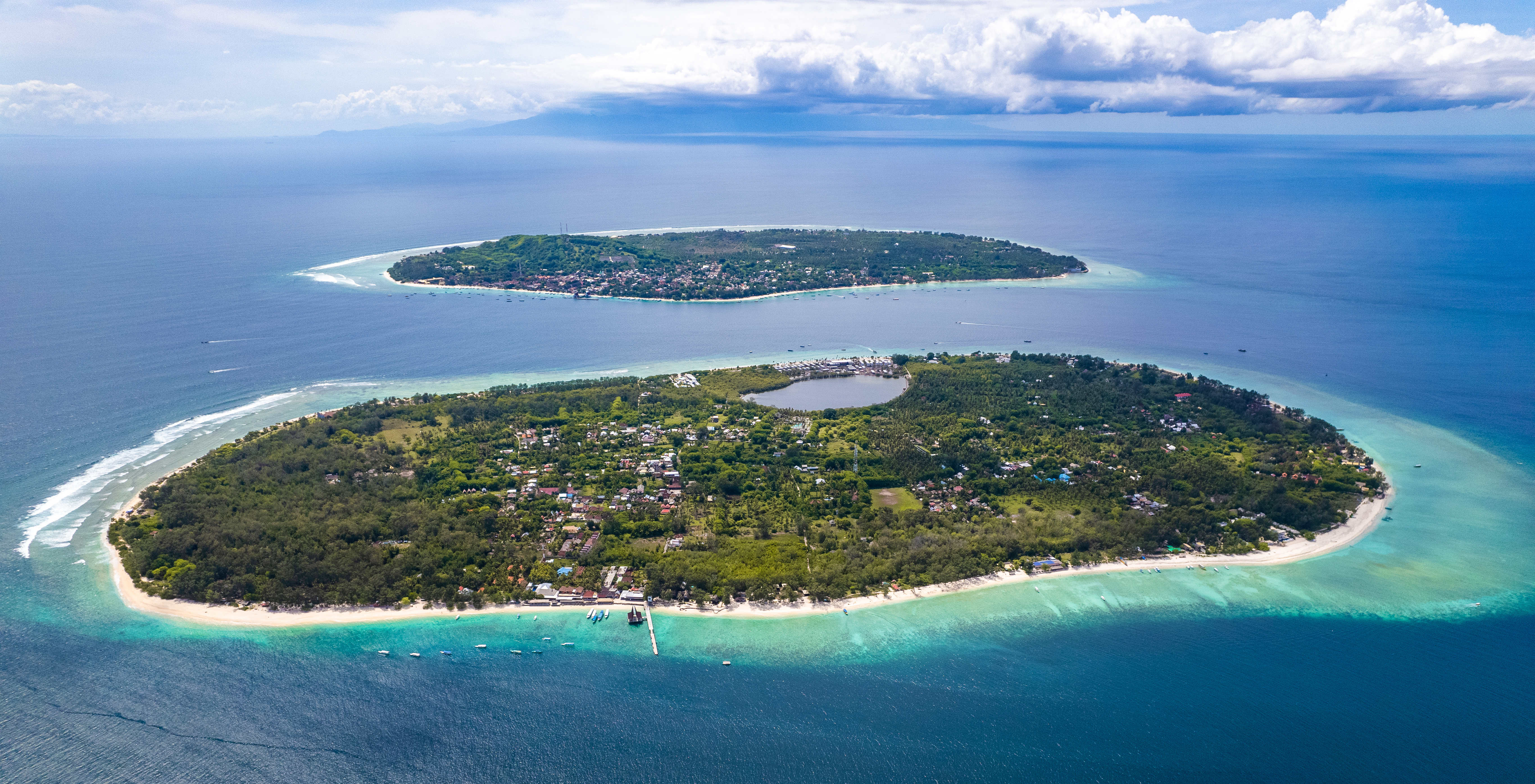
Gili Matra - a group of three islands, Gili Ayer, Gili Meno and Gili Trawangan, in Indonesia - has been a protected area since 1993. Its current management plan, running to 2034, splits the park into six zones with levels of protection or restriction varying from areas open to tourism to a strict no-take zone, which covers just 3% of the area. In 2021, the government’s standard management-effectiveness assessment rated the park “optimally managed” with a score of 64 out of 100.
That single number, however, does not describe how ecosystems within the protected area are changing over time, whether the governing institutions are adequately resourced, or how local communities experience and benefit from living alongside it.
To dive deeper into the numbers, researchers and decision-makers at Indonesia’s Ministry of Marine Affairs and Fishers, Rekam Nusantara Foundation, and the Global Ocean Accounts Partnership (GOAP) piloted the governance accounts for Gili Matra.
What the governance accounts revealed
Gili Matra’s ocean account offered a more nuanced perspective of the single “optimally managed” score. Between 2015 and 2021, government data show coral cover and reef area both declined, mangrove cover shrank by more than half and seagrass expanded. While these three habitats experienced different trends, they had previously been compiled into one management score. A 2021 reef fish survey found more fish overall than in 2015, but lower total biomass: the reef was gaining small fish faster than it could regrow the larger ones that keep populations stable.
Governance accounts can be used to better understand the potential mechanisms that may be behind these ecological trends. As Hadi Yoga Dewanto, Ocean Accounts Fellow at the GOAP Secretariat explains, “each marine area does not have just one or two governance regimes, it can hold conservation rules, shipping lanes, and oil, gas or cable corridors all at once. By mapping these spatial overlaps against expenditure and enforcement records, we can visualise the full extent of these relationships and integrate them directly into the decision-making process.”
At Gili Matra, the governance accounts show that four institutional levels share responsibility: the national Ministry of Marine Affairs and Fisheries through its local Satker, the West Nusa Tenggara provincial government, North Lombok Regency, and Gili Indah village. That shared authority takes spatial form in a six-zone system, spanning core, sustainable fisheries, utilization, protection, rehabilitation and port zones. The zones balance strict conservation against economic use. It operationalises through activity rules restricting where tourism and fishing gear can operate, and banning destructive fishing and anchoring outside the port zone.
More importantly, the governance accounts shows a financing gap that ecological data alone could not have shown. The unit managing Gili Matra spent almost IDR 600 million (around US$45,000) in 2021 protecting the area and collected IDR 19 million (US$1,060) in official revenue. Gili Indah village, the community on these islands, contributed a further IDR 45 million (US$2,500) to manage the area, which it depends on for its tourism economy.
By combining governance data with the environmental, social and economic data contained in the ocean account, the team found that Gili Matra delivers real value to tourism and fisheries and has clearly defined institutional mandates, but economic returns are not keeping pace, and biodiversity protection may not be either.
Beyond Gili Matra
Ocean accounting enables decision-makers to understand not only how a protected area changes ecologically over time, for example shifts in the size or health of ecosystems, but also how financing, management and community engagement shape its ecological, social and economic outcomes.
Indonesia has adopted a national ocean accounting roadmap and embeds ocean accounting within its development plan through to 2045, targeting a fully operational national system by 2026 and its use as a decision-support tool across all levels of government by 2029. Within this system, governance accounts will support mapping overlapping institutional arrangements against spending and enforcement data so decision-makers managing Indonesia’s wider MPA network can see, for each site, who is responsible, what they spend, and how that compares to what the area brings in.
Marine protected areas last only as long as the institutions built to sustain them, and monitoring their progress is not something a government does once.
The Ocean Accounts of Gili Matra are led by the Ministry of Marine Affairs and Fisheries, Indonesia, Rekam Nusantara Foundation, the Indonesia Ocean Accounts Task Force and the GOAP.